Hagerstown, Maryland
Koordinatlar: 39°38′34″K 77°43′12″B / 39.64278°K 77.72°B
| Hagerstown | |
| — Şehir — | |
| Hagerstown şehri | |
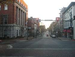 Şehirden görünüm 29 Kasım 2009 |
|
 Hagerstown Flint'in ABD'daki konumu |
|
| Koordinatlar: 39°38′34″K 77°43′12″B / 39.64278°K 77.72°B | |
| Ülke | |
|---|---|
| Eyalet | Maryland |
| İlçe | Washington |
| Yönetim | |
| - Belediye başkanı | David S. Gysberts |
| Yüzölçümü | |
| - Toplam | 132,99 km2 (51,3 mi2) |
| Nüfus (29 Kasım 2009[1]) | |
| - Toplam | 39.662 |
| - Yoğunluk | 485/km² (1.256,1/sq mi) |
| Zaman dilimi | PZD (-8) |
| İnternet sitesi: www.hagerstownmd.org | |
Hagerstown, Amerika Birleşik Devletleri'nin Maryland eyaletinde yer alan ve Washington ilçesinde yer alan bir şehirdir.[2] Şehrin nüfusu 29 Kasım 2009 tarihinde 39,662, metropol nüfusu 269,140'dur.
Kardeş şehirler
-
 Wesel, North Rhine-Westphalia, Germany (since 10 March 1952).[3]
 -
 Hagerstown, Indiana, U.S. (unofficial)
Kaynakça
- ↑ "Population Estimates". United States Census Bureau. http://www.census.gov/popest/data/cities/totals/2012/SUB-EST2012.html. Erişim tarihi: 2010-02-12.
- ↑ "Find a County". National Association of Counties. 26 Haziran 2015 tarihinde kaynağından arşivlendi. http://web.archive.org/web/20150626142102/http://www.naco.org/Counties/Pages/FindACounty.aspx. Erişim tarihi: 2010-02-12.
- ↑ "Augustoberfest". City of Hagerstown, MD. http://www.augustoberfest.org/history.html. Erişim tarihi: 2007-07-07.
Dış bağlantılar
| ||||||||||||||||||||
This article is issued from Vikipedi - version of the 11/26/2016. The text is available under the Creative Commons Attribution/Share Alike but additional terms may apply for the media files.